Getting Around Mexico City — Practical, Sustainable Transit for a 3-Day Visit
How to move around Mexico City efficiently and responsibly during a short trip. Practical routes, transport realities, neighborhood tips, where to catch buses to Cuernavaca/Toluca/Morelia, and local-first advice tied to a 3-day itinerary.
Quick, practical guidance to navigate Mexico City: airport transfer, Metro and Metrobús tips, bike and walking options in Condesa–Roma, where to board intercity buses, and sustainable, low-impact choices that support local businesses.
Quick Answer
Quick, practical guidance to navigate Mexico City: airport transfer, Metro and Metrobús tips, bike and walking options in Condesa–Roma, where to board intercity buses, and sustainable, low-impact choices that support local businesses.
Who This Page Is For
This page is for travelers planning a stay in Mexico City who want clearer decisions about getting around, local logistics, timing, budgeting, and practical trip planning.
How This Page Was Prepared
This page was prepared through a structured editorial workflow that combines destination research, geographic context, and practical travel-planning review.
Plan the Rest of Your Trip
Use this page together with the full itinerary and the related planning pages below to make better booking, timing, transport, and budget decisions.
For a short stay: use the Metro and Metrobús for the cheapest and fastest cross-city travel; use Ecobici or walk inside Condesa–Roma and Coyoacán; take authorized long-distance buses from the correct terminal for Cuernavaca, Toluca, Morelia and San Miguel. Use ride-hailing apps for late-night trips or door-to-door convenience when travel is off-peak.
Highlights:
- Metro/Metrobús: fastest and most sustainable for most central connections.
- Ecobici and walking: best for short hops inside Roma/Condesa/Centro/Coyoacán.
- Buses: depart from specific terminals (Norte, TAPO/Oriente, Sur/Tasqueña, Observatorio) — check the operator and terminal before you go.
- Airport: official taxis, authorized app pickups, Metro Line 5 (Terminal Aérea) and Metrobus connections to Terminals 1 & 2.
Mexico City is enormous but often surprisingly navigable if you match routes to neighborhoods and the time of day. This page is a compact, practical guide to help you move through the city during a three-day stay: key public transit lines, local taxis and ride apps, bike options, where to catch buses to nearby cities such as Cuernavaca or Toluca, and simple habits to stay safe and low-impact.
Read this alongside our main 3 days in Mexico City itinerary to time museum visits, meals, and day trips so transport feels like part of the experience instead of an obstacle.
What This Page Helps You Decide
This page helps you choose the right mode of transport based on time, budget, neighborhood and sustainability priorities.
Use it to decide:
- Whether to take Metro or a taxi for a particular leg of your 3-day itinerary.
- How to plan a day trip to Cuernavaca, Toluca, Morelia or San Miguel de Allende from the correct bus terminal.
- When to walk or rent an Ecobici bike instead of taking motorized transport.
- Practical ways to avoid rush-hour crowds and manage luggage on public transport.

Top Recommendations
1) Use the Metro and Metrobús for efficiency and low impact.
- Buy and top up a reusable Metro/transport card at stations. Metro is fastest across long distances but avoid peak commute windows (Mon–Fri roughly 7:00–9:30 and 17:00–20:00).
2) Walk and bike in compact neighborhoods.
- Condesa, Roma, Centro Histórico and Coyoacán are best explored on foot or by Ecobici. Sundays the Paseo de la Reforma closes to cars for the ciclovía—great for low-impact exploration.
3) Choose the right bus terminal for intercity travel.
- Terminal del Norte: northbound routes. TAPO (Oriente): east and southeast. Terminal del Sur/Tasqueña: southbound routes including Cuernavaca. Observatorio: western routes including Toluca.
4) Use ride-hailing apps (Uber, DiDi) for late-night or luggage-heavy transfers.
5) Time your visits: choose shoulder months (March–May; Sep–Nov) to avoid the worst summer rains and December crowds.

Local Context
Neighborhoods and travel patterns:
- Centro Histórico: compact, many sites within walking distance but cobblestones and uneven sidewalks mean comfortable shoes and daylight travel are best. Use the Metro (Zócalo, Allende) to approach from farther away.
- Roma & Condesa: tree-lined avenues and cafés make walking or Ecobici ideal. Short taxi/ride-app hops are common at night.
- Coyoacán & Xochimilco: these feel village-like; allow extra time for bus or taxi connections and expect slower local traffic.
Transport realities:
- Capacity beats comfort: the Metro is very crowded at rush hour; Metrobús runs on dedicated lanes and is a good alternative for north–south trips on Reforma and Insurgentes.
- Cash and cards: the Metro card is still essential for many services; some buses and markets remain cash-first.
- Language and etiquette: a simple buenos días or buenas tardes is appreciated. Keep bags zipped and move aside to let people on/off quickly.
Seasonal notes:
- Rainy season (June–September) brings afternoon thunderstorms—carry a light rain jacket and plan open-air activities for mornings. Air quality can be an issue in winter and spring; check local advisories if you have respiratory concerns.

How to Choose Well
Match transport mode to the trip:
- Short neighborhood hops (under 2–3 km): walk or bike. This supports local cafés, markets and reduces emissions.
- Cross-city daytime trips: Metrobús or Metro; Metrobús is easier with luggage and on Reforma/Insurgentes corridors.
- Night or door-to-door with luggage: ride-hailing apps or booked airport taxi. Use official stands at the airport.
- Day trips to nearby cities: pick the terminal that serves your destination and book reputable carriers (Primera Plus, ETN, ADO where applicable). Reserve seats ahead for holidays and weekend travel.
Booking tips:
- Book intercity buses online in advance for peak dates; printed or digital tickets are accepted. Check departure terminal carefully—different companies use different terminals.
- For Metro cards and Ecobici, download official apps or buy at stations to avoid lines.
- Keep an offline map (or downloaded area in Google Maps) and note major transfer stations: Pantitlán, Centro Médico, Observatorio, Indios Verdes, Tacubaya, Hidalgo.

Responsible and Local-First Tips
Support the local economy and lower your impact:
- Favor public transit, shared transport, and bike or walking tours led by local guides.
- Eat at neighborhood markets (Mercado Roma, Mercado de San Juan, Mercado Medellín) and tip vendors when you buy food or guided stalls.
- Use licensed taxis or registered ride-hailing drivers. At the airport, use authorized taxi booths or app pickup zones to ensure drivers are regulated.
- Bring a reusable water bottle and shopping bag to reduce single-use waste; many markets and cafés will refill or accept them.
- When taking photos, ask permission before photographing vendors or people in close-up; small purchases are a good way to show appreciation.

Common Mistakes to Avoid
- Mistake: Taking the Metro at peak commute times with heavy luggage. The Metro is crowded; wait for off-peak or choose Metrobús/ride-hail for luggage.
- Mistake: Standing on the wrong side when queuing for buses or Ecobici docks. Check where locals board to avoid confusion and delays.
- Mistake: Assuming all intercity buses depart from the same terminal. Always confirm the terminal on your ticket—Norte, TAPO, Sur/Tasqueña and Observatorio serve different directions.
- Mistake: Leaving belongings in an unattended bag or backpack while exploring markets. Keep valuables close and use front-worn packs in crowded places.
- Mistake: Underestimating travel times across the basin during afternoon traffic. Allow extra time for transfers and return trips, especially toward airports or long-distance terminals.
FAQ
What's the fastest way from Benito Juárez Airport (AICM) to the Centro Histórico?
The fastest reliable options are a direct authorized taxi/ride-hail (allow 30–60 minutes depending on traffic) or Metro + Metrobus combinations on good traffic days. Metro Line 5 goes to Terminal Aérea station; transfer points vary by destination. For comfort with luggage, use an airport-authorized taxi or prebooked transfer.
Are ride-hailing apps safe and recommended?
Yes—Uber, DiDi and similar apps are widely used and generally safer than flagging street taxis. Confirm driver details and plate before entering. For airport pickups, use the official app pickup zones or authorized counters.
Which bus terminal should I use for Cuernavaca, Toluca, or Morelia?
Cuernavaca: many buses leave from Terminal del Sur/Tasqueña. Toluca: most services depart from Observatorio (west). Morelia, San Miguel de Allende and Guanajuato: check departures from Norte, Occidente/Observatorio or TAPO depending on the operator—always verify the terminal on your ticket.
Can I use one transit card across Metro, Metrobús and Ecobici?
Integration is improving but varies. Buy and top up the rechargeable transport card at major stations; some services accept contactless bank cards. For Ecobici, register online or at kiosks for daily or multi-day passes.
How do I avoid pollution or smog days impacting outdoor plans?
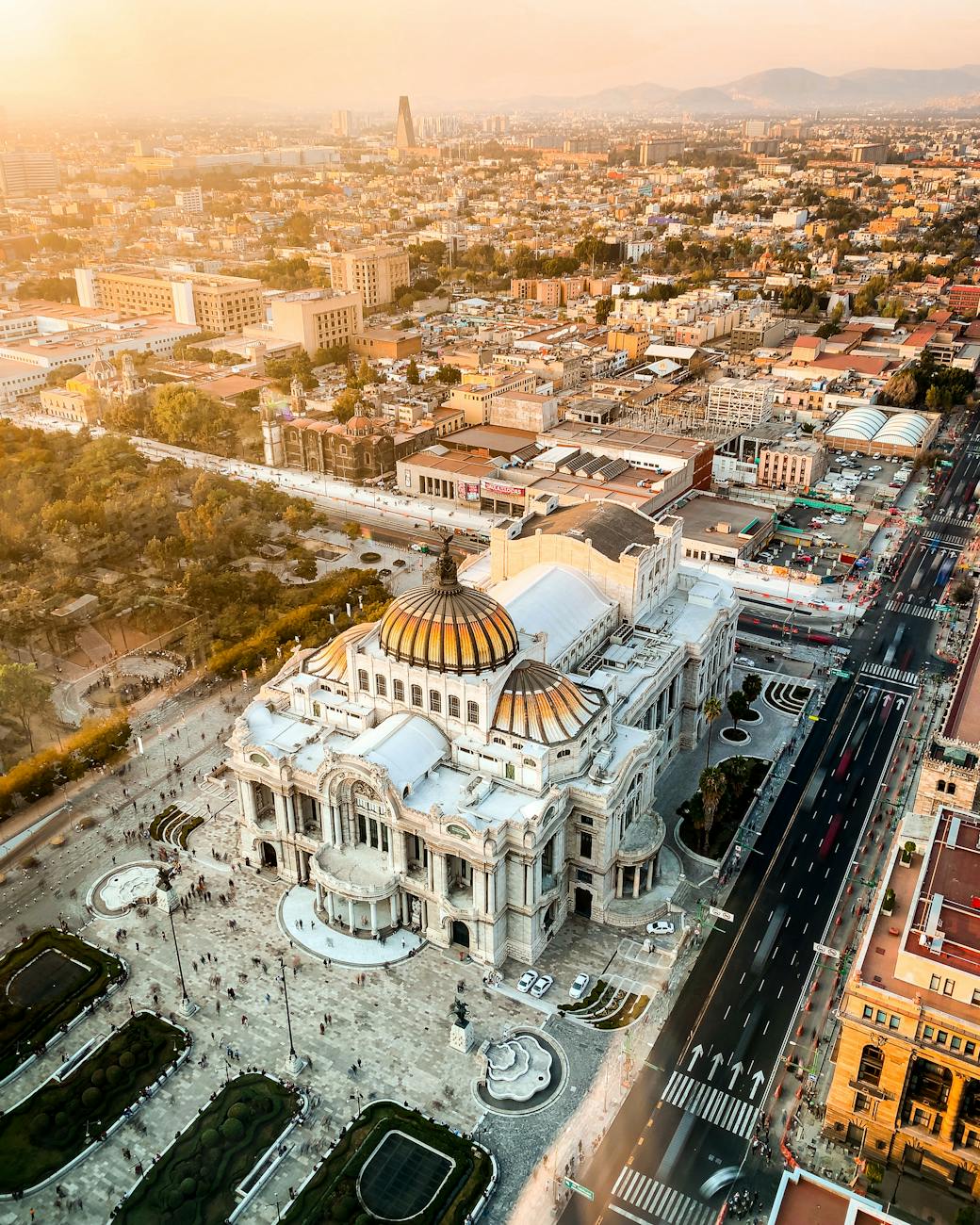
Check local air-quality indexes (IMECA) and shift outdoor museum walks or park visits to mornings. On high-alert days, favor indoor sites like Museo Nacional de Antropología or Palacio de Bellas Artes and use public transport rather than cycling if advised.
Conclusion
With a little planning you can move through Mexico City efficiently, support local businesses and keep your visit low-impact. Use Metro and Metrobús for long central legs, walk and Ecobici inside denser neighborhoods, and pick the correct bus terminal for day trips to Cuernavaca, Toluca and beyond. Pair this guide with the 3 days in Mexico City itinerary to sequence activities by neighborhood and minimize travel time so you spend more of your trip enjoying the city.
How this guide was prepared
This guide was prepared through a structured research that combines destination research, geographic context, itinerary planning logic, and content review.