
Getting Around San Francisco: Practical, Low-Impact Transport for a 3-Day Visit
How to move efficiently and sustainably around San Francisco: transit passes, bike and ferry options, neighborhood tips, airport transfers, and low-impact day trips to Oakland, Fremont, Sunnyvale, South San Francisco, and Napa.
Practical advice for navigating San Francisco during a short trip: pick the right neighborhood, use Clipper with Muni/BART/ferries, favor walking and bikes, and choose sustainable day-trip routes to Oakland, Fremont, Sunnyvale, South San Francisco, and Napa.
Quick Answer
Practical advice for navigating San Francisco during a short trip: pick the right neighborhood, use Clipper with Muni/BART/ferries, favor walking and bikes, and choose sustainable day-trip routes to Oakland, Fremont, Sunnyvale, South San Francisco, and Napa.
Who This Page Is For
This page is for travelers planning a stay in San Francisco who want clearer decisions about getting around, local logistics, timing, budgeting, and practical trip planning.
How This Page Was Prepared
This page was prepared through a structured editorial workflow that combines destination research, geographic context, and practical travel-planning review.
Plan the Rest of Your Trip
Use this page together with the full itinerary and the related planning pages below to make better booking, timing, transport, and budget decisions.
Best overall strategy: center your stay near a transit hub (Union Square, Embarcadero, or SoMa), buy a Clipper card, combine walking + Muni + occasional BART or ferry, and use Bay Wheels bikes or guided walking tours for short hops. Reserve cars only for group day trips outside the Bay Area. For trips to Oakland use ferry or BART; to Sunnyvale use Caltrain from 4th and King; for Fremont use BART; for Napa consider a shared shuttle or a ferry + bus connection.
This page gives targeted, practical guidance for getting around San Francisco during a short visit and supports our companion itinerary, 3 days in San Francisco. It focuses on low-impact, local-first choices: walkable neighborhoods, public transit options (Muni, BART, ferries), bike lanes, and sensible car avoidance. Use these tips to spend less time stuck in traffic and more time supporting neighborhood businesses.
What This Page Helps You Decide
Use this page to quickly choose between transit, bike, or car for specific needs.
Key decisions covered:
- Where to stay so you can rely on public transit and walking.
- How to get between SFO and downtown efficiently.
- Whether to take BART, ferry, or Caltrain for nearby cities.
- When a rental car or rideshare makes sense (and when it doesn't).
- How to plan low-impact day trips to Oakland, Fremont, Sunnyvale, South San Francisco, and Napa.
If you want a day-by-day plan that uses these transport choices, see our 3 days in San Francisco itinerary for route examples and timings.

Top Recommendations
Start with these priorities for a smooth, sustainable visit:
- Get a Clipper card: Use it on Muni, BART, and most ferries. It saves time and reduces paper tickets.
- Walk neighborhoods: North Beach, Chinatown, Mission, Hayes Valley and the Embarcadero are especially walkable; plan for hills in Russian Hill and Nob Hill.
- Take the ferry where practical: Golden Gate Ferry to Sausalito/Larkspur and San Francisco Bay Ferry to Oakland/Alameda are scenic and less congested than bridges.
- Use bike shares selectively: Bay Wheels is great for flat waterfront rides (Embarcadero, Golden Gate Park). Avoid hilly streets unless you’re an experienced e-biker rider.
- Reserve cars only for Napa or late-night airport runs when transit isn’t available; for Napa prefer a shared shuttle or organized small-group tour to minimize single-occupant driving.
- Book key experiences early: Alcatraz and some ferry departures sell out weeks in advance—reserve ahead from the main 3-day itinerary's recommended time slots.
Practical tools: MuniMobile or Clipper app for fares, Transit or Google Maps for real-time connections, and local luggage-storage services if you have late trains or early flights.

Local Context
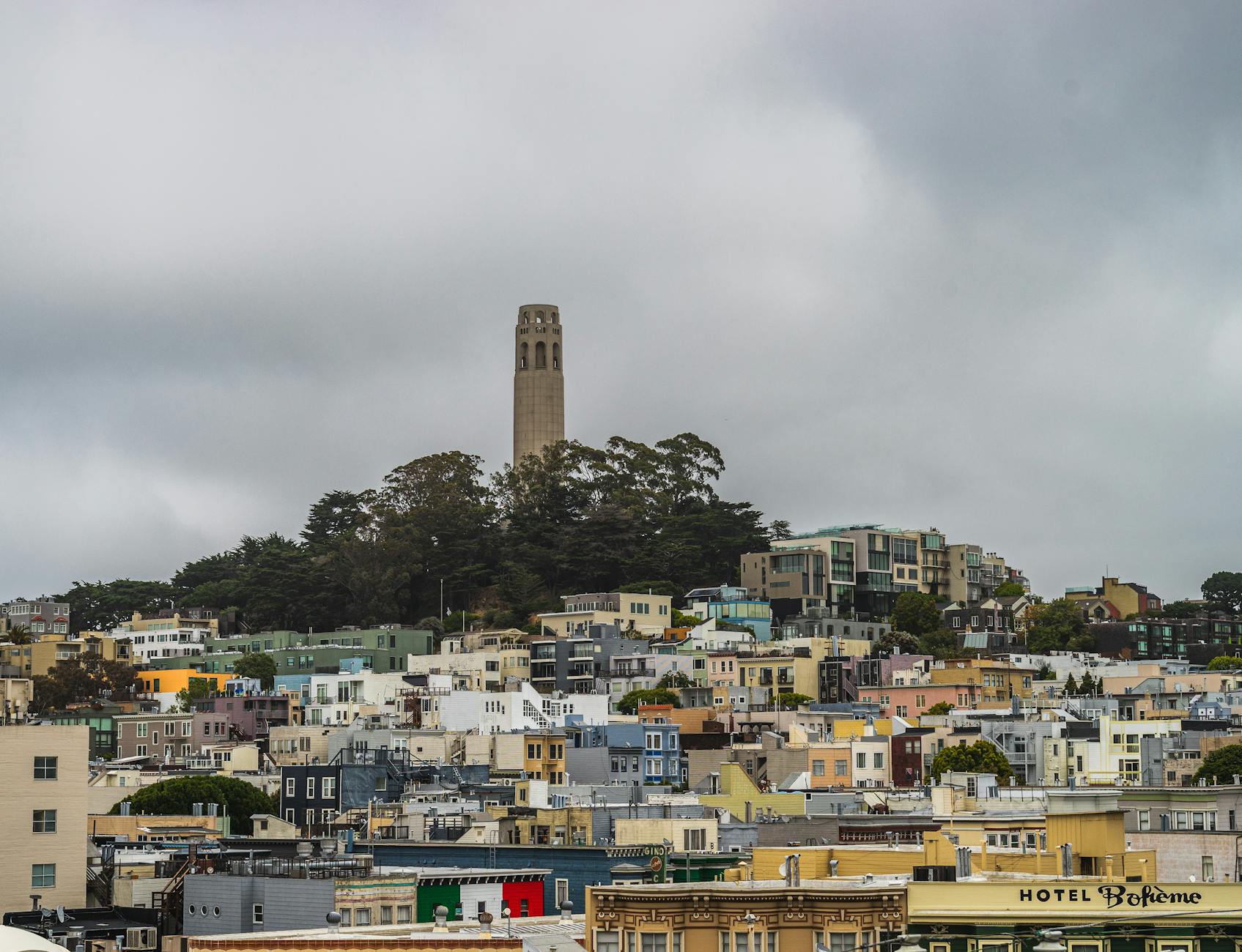
San Francisco is compact but geographically varied: steep hills, peninsular winds, and strong microclimates mean a short walk can change from sun to fog. Typical patterns:
- Weather: "June Gloom" often brings foggy mornings in late spring; September–October are frequently the sunniest and warmest.
- Hills: The western neighborhoods and Nob Hill are steep; plan walking routes to avoid long ascents if mobility is a concern.
- Transit roles: Muni covers local buses, cable cars, and light rail inside the city. BART is rapid regional transit connecting Oakland, Fremont, and SFO to downtown. Caltrain runs from SF south to Sunnyvale and beyond.
- Tourist vs. local routes: Cable cars are iconic but slow and crowded—use them for the experience, not as an efficient commute tool. Ferries and buses often offer faster cross-bay options.
Neighborhood notes:
– Union Square/Chinatown: central for first-time visitors and hotel options.
– Embarcadero/Ferry Building: great for ferries, morning markets, and waterside walks.
– Mission: sunny, food-focused, and excellent on-foot exploration.
– SoMa: close to Moscone Center and museums; quieter on weekends.
Transit hours and reliability vary by route and season; check apps for overnight or holiday service changes.

How to Choose Well
Match transport to your priorities and itinerary:
- If you want relaxed sightseeing and local cafes: pick a centrally located hotel near Union Square, Market Street, or the Embarcadero to minimize transit time.
- If you value scenic commutes: take ferries to Oakland/Alameda or a Golden Gate Ferry to Sausalito + walk the waterfront.
- If your plan includes Silicon Valley (Sunnyvale): use Caltrain from 4th & King—book seats for commute hours if you have a fixed schedule.
- If you need the airport: BART from SFO to Powell/Embarcadero is fast and cost-effective; permit extra time for luggage during peak hours.
- For day trips to Napa: prefer shared shuttles, organized tours, or combined ferry + shuttle options rather than driving solo to reduce emissions and parking hassle.
Booking tips:
– Clip card or app: buy Clipper before your first journey or at many transit stations.
– Alcatraz and popular guided neighborhood walks sell out—book at least 2–3 weeks ahead in high season.
– Check ferry schedules the day before; some routes are reduced on weekends or holidays.

Responsible and Local-First Tips
Choose low-impact options and support the local economy:
- Prioritize public transit, ferries, walking, and shared bikes over single-occupancy cars.
- Spend in neighborhoods: buy coffee from corner cafés in the Mission or groceries from the Ferry Building vendors to keep tourist dollars local.
- Use licensed local guides for walking tours; many are independent operators who reinvest directly into neighborhoods.
- Pack a reusable water bottle and bag—San Francisco enforces single-use plastic reductions and many vendors offer discounts for reusable cups.
- Park and bike respectfully: don’t block sidewalks or bike lanes with scooters or luggage; return shared bikes to designated docks.
- Consider off-peak travel: shoulder seasons (September–October, late spring) reduce crowding and pressure on local services.
Safety and respect:
– Ask before photographing people or private property in residential neighborhoods.
– Follow local rules for crosswalks and bike lanes and yield to transit riders boarding vehicles.
Common Mistakes to Avoid
Mistakes that slow you down or cost more:
- Renting a car for central San Francisco sightseeing: expensive parking and heavy traffic make this inefficient.
- Underestimating hills and weather: bring layered clothing and plan routes that avoid long climbs if needed.
- Treating cable cars as practical transport: they're slow and tourist-filled—use for short experiences, not daily transfers.
- Not buying a Clipper card or loading passes: paying cash or single tickets wastes time and can be more expensive.
- Assuming ferries and some transit run late-night: check schedules—overnight service is limited on many routes.
- Ignoring neighborhood norms: noisy, late-night behavior or blocking sidewalks damages local goodwill.
FAQ
What's the easiest way to get from San Francisco International (SFO) to downtown?
Take BART from SFO to Powell, Montgomery, or Embarcadero for a direct, affordable trip. A Clipper card speeds boarding; allow 30–50 minutes depending on station and time of day.
Do I need a car to visit nearby cities like Oakland, Fremont, Sunnyvale, South San Francisco, or Napa?
No for most visitors. Use BART or ferries to reach Oakland and Alameda. Caltrain runs to Sunnyvale (from 4th & King). Fremont is on BART. For Napa, prefer a shared shuttle, organized tour, or ferry + land shuttle via Vallejo to avoid parking and reduce emissions.
Is it safe to walk and use transit at night?
Many central areas are busy and well-lit; ordinary precautions apply—stay on main streets, keep valuables discreet, and use well-known transit stops. For late-night travel, prefer official rideshare pickup zones, taxis, or plan routes that use frequent, staffed stations.
Can I bike across the Golden Gate Bridge?
Yes—there are dedicated bike lanes on the bridge and bike rentals near Fisherman's Wharf and the Marina. Be prepared for winds and steep approaches; consider an e-bike only if you're comfortable with traffic and hillier sections.
How early should I book Alcatraz and popular tours?
Book Alcatraz at least 2–4 weeks ahead in high season; neighborhood food tours and unique museums often sell out for weekend slots—reserve as soon as your dates are set.
What transit apps or cards should I use?
Carry a Clipper card (physical or mobile) for most services, use Transit or Google Maps for live departures, and install MuniMobile for some Muni passes. Ferry operators have their own ticketing—check ferry schedules in advance.
Conclusion
Plan around transit hubs, buy a Clipper card, and favor walking, bikes, and ferries to keep your visit low-impact and locally beneficial. For route examples and a full daily plan that uses these recommendations, see our 3 days in San Francisco itinerary. If you want to visit nearby cities, the most sustainable choices are ferry to Oakland, BART to Fremont, Caltrain to Sunnyvale, and shared shuttles or organized tours to Napa. Small choices—choosing public transit, local guides, and neighborhood cafés—add up to a much richer trip for you and the city.
How this guide was prepared
This guide was prepared through a structured research that combines destination research, geographic context, itinerary planning logic, and content review.