

3-Day South San Francisco Itinerary — Practical Weekend Guide
A practical 3-day South San Francisco guide with transit tips, realistic budgets, neighbourhood walks, and candid advice for a short Bay Area visit.
A clear, no-fluff 72-hour plan for South San Francisco: how to get around, what to prioritise, where to eat and where to sleep, tuned to short-stay travellers.
First impressions: edges and layers. Expect wide arterials, low-rise office parks, older single-family neighborhoods, a working waterfront, and unexpected Bay views from hilltops. The dominant feel combines weekday corporate energy around Oyster Point and quieter residential streets around Grand Avenue and Orange Memorial Park. The city’s nickname — "The Industrial City" — is literal: manufacturing and, more recently, biotech presence shape traffic patterns, lunch crowds, and where public amenities sit.
Many visitors arrive thinking this is a miniature San Francisco. That assumption causes two problems: underestimating distances between sites, and overestimating evening options. The best visitors are those who want short hikes, waterfront time, and to observe how the Bay Area’s corporate edge sits next to older neighborhoods. Noise, freeway traffic, and parking enforcement matter here; the trade-off is easy access to San Francisco International Airport (SFO) and a different, more utilitarian Bay view than the tourist-heavy piers across the bay.
Is 3 days in South San Francisco enough?
Three days is enough to cover downtown Grand Avenue, Sign Hill, Oyster Point Marina, and an exploration of the biotech/API campus edges and San Bruno Mountain. One honest caveat: in 72 hours there is no time for a full day trip into San Francisco proper plus full hikes on San Bruno Mountain — pick one.
Who This Guide Is For
Best for travellers who want short urban hikes, waterfront walks, and insight into Bay Area biotech development. Not ideal for visitors who expect dense nightlife or museum-heavy itineraries.
Local Tips for South San Francisco
Practical details that most travel sites skip — specific to South San Francisco.
- Sign Hill’s white concrete letters read 'SOUTH SAN FRANCISCO THE INDUSTRIAL CITY' and the main trailhead is off County Road/Sign Hill Road; allow 30–45 minutes round trip to the main overlook.
- Oyster Point Marina Park has a paved 1.5-mile waterfront promenade and public parking; it’s a reliable sunrise spot and the marina area often enforces parking time limits on weekends.
- South San Francisco has both Caltrain (South San Francisco station on the Peninsula corridor) and a BART stop (South San Francisco station on the SFO–Millbrae branch); use a Clipper card across modes to avoid separate payments.
- Grand Avenue is the downtown artery; the South San Francisco Public Library branch is at 420 Grand Ave and weekday on-street parking meters are enforced until 6pm on many blocks.
- Genentech’s large corporate campus sits off Highway 101 around Oyster Point and Sierra Point; its presence explains why many weekday restaurants fill with office workers between 12:00–13:30.
How This Guide Was Prepared
South San Francisco is best understood as a working-edge Bay Area city where large biotech campuses meet older residential streets and a waterfront marina. Many guides treat it like a bedroom community for San Francisco; this one treats it as a place with its own routes, industry landscape, and overlooked views, and gives realistic time budgets rather than selling it as a mini-San Francisco. This guide was prepared through a structured research that combines destination research, geographic context, itinerary planning logic, and content review.
Plan Your Stay in South San Francisco
Use this itinerary as your starting point, then compare areas to stay, transport options, seasonal timing, and realistic daily costs before booking.
Why Visit
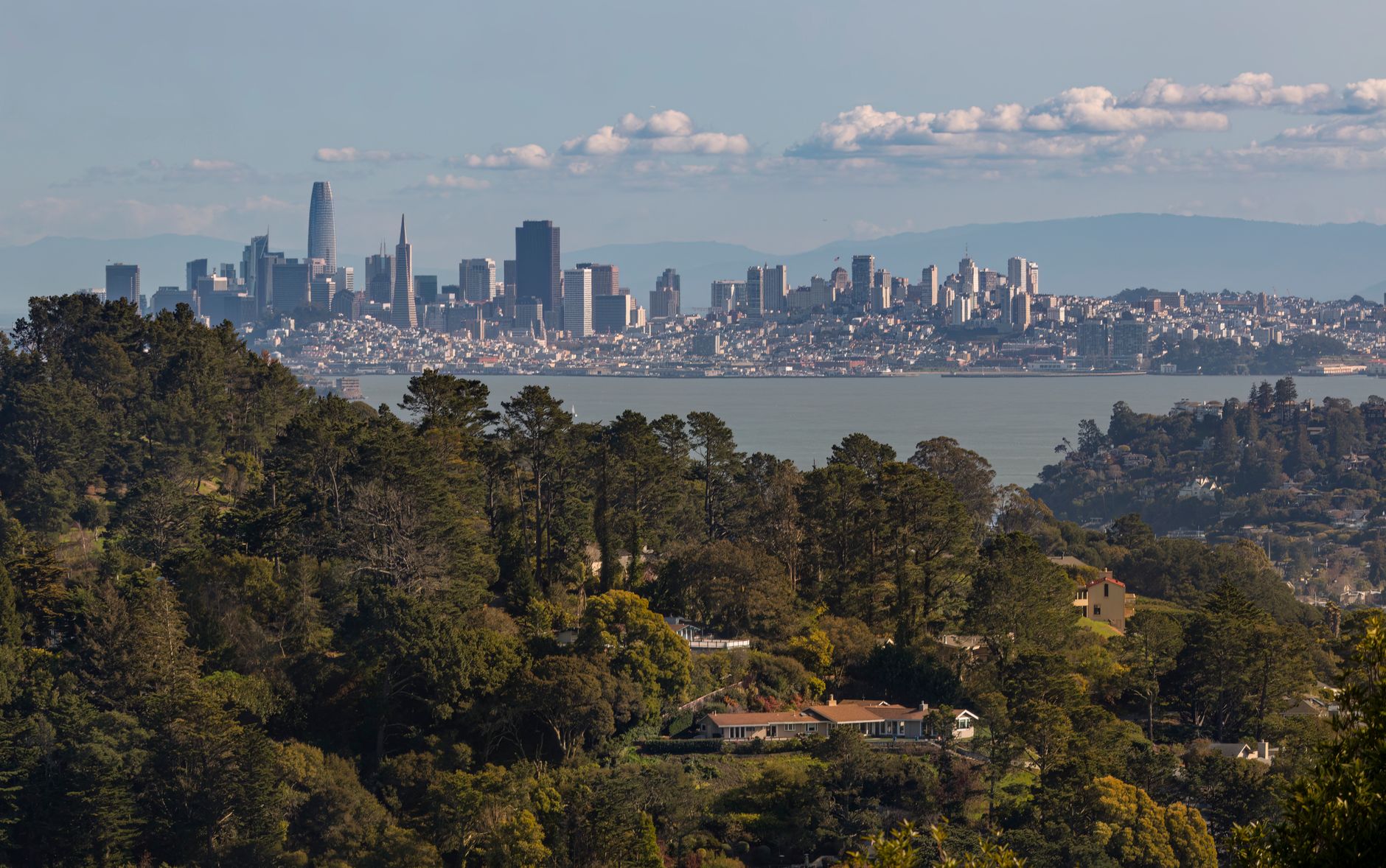
Reason 1: Bay views with a working-port edge. Oyster Point Marina Park and the San Bruno Mountain ridgeline offer views of the bay, container yards, and aircraft approaches to SFO that are more industrial than glam but highly photogenic when light is low.
Reason 2: Short, useful hikes and overlooks. Sign Hill Park is a compact hike that rewards with a city-wide panorama and a clear local landmark. San Bruno Mountain State Park has longer trails and rare serpentine grassland if a half-day hike is wanted.
Reason 3: A front-row seat on Bay Area biotech. The Genentech campus and Pacific Shores business park show how industry clusters operate; short walks near these campuses reveal cafeteria hours, coffee queues, and weekday restaurant patterns that make for efficient planning.
Reason 4: Practical Bay Area base. Proximity to SFO, quick Caltrain and BART links, and a lower per-night price than central San Francisco make this a pragmatic choice for short stays focused on transit, meetings, or light outdoor activity.

Quick Planning Tips
Arrive and leave: the fastest public route from SFO is BART (SFO station) to South San Francisco station; a taxi or rideshare is usually 10–20 minutes depending on traffic. From downtown San Francisco, Caltrain to South San Francisco station puts Grand Avenue within a 10–12 minute walk.
Payment and apps: use a Clipper card for BART, Caltrain, and SamTrans buses; the Clipper app can top up balances and is accepted across these modes. For real-time transit info, use the official BART app and Caltrain’s mobile schedule; Google Maps reliably shows SamTrans bus departures.
One planning mistake to avoid: assuming pedestrian shortcuts exist under or across Highway 101. Many reasonable-sounding routes on maps are blocked by fencing, and walking around overpasses can add 15–25 minutes. If a schedule includes catching a midday return train or flight, build an extra 30–45 minutes for crossing the freeway corridors.

Day 1
Morning: Start at the South San Francisco Caltrain Station. From the platform it’s a short 10–12 minute walk east to Grand Avenue. Spend 60–90 minutes strolling Grand Avenue’s cafés, bakeries, and small shops; look for weekday coffee queues around 8:00–9:30 when office workers stop in. Walk time from the station to the main stretch of Grand Ave is flat and suitable for luggage if arriving by train.
Late morning: Head north to Sign Hill Park. The trailhead from Westborough Boulevard is about a 6–10 minute drive or a 30–40 minute walk from Grand Avenue. The main loop to the lettered sign and back can be 30–45 minutes; bring water and a windbreaker. The overlook gives clear skies views over the city and bay when conditions are right.
Lunch: Return toward Grand Avenue for lunch at a long-standing local diner or hotel restaurant near the center of town (many weekday places fill with office workers between 12:00–13:30, so arrive early or after 13:30). If using a car, try the small lots behind restaurants off Grand Avenue.
Afternoon: Drive or ride to Oyster Point Marina Park (10–15 minutes from Grand Avenue by car). Walk the paved sliver of waterfront and check the marina piers. From Oyster Point, Pacific Shores Business Park is a short drive if there is interest in viewing the office complex exterior and waterfront office plazas.
Evening: Dinner near the marina or back on Grand Avenue. Weekday evenings can be quiet; many independent places close by 21:00, and chains stay open later. For a low-key evening, head to Oyster Point for sunset and then back to Grand Avenue for a casual meal. If staying out later, review pickup spots for rideshares; busy office shuttles can block curb space on Oyster Point Boulevard.

Day 2
Morning: Drive or take a short ride to San Bruno Mountain State Park. Enter via Crestview Drive or the north parking area; plan for at least 2–3 hours if taking the Summit Loop or the Vista Grande trail. The mountain offers a different character from the waterfront: exposed ridges, open scrubland, and sweeping views toward Daly City and San Francisco. Trails can be windy and rocky; proper shoes are advised.
Late morning: Stop at Skyline Boulevard viewpoints if time allows, then head down to the Westborough and Linden neighborhoods for a quieter residential walk. Westborough’s tree-lined streets and mid-century houses show the city’s postwar expansion and are a good contrast to office parks.
Lunch: Try a local family-run taqueria or Filipino restaurant in the area; midday crowds often include construction and lab workers, so expect quick service and hearty portions. Many smaller places take cash and cards.
Afternoon: Visit the South San Francisco Public Library on Grand Avenue and then walk to Orange Memorial Park for green space and sports fields. If interested in local history, contact the South San Francisco Historical Society for current exhibits or walking tour leaflets; their materials often live at the library or civic center during weekdays.
Evening: Explore the northern industrial edge near Airport Boulevard for casual dinner options or return toward Oyster Point for waterfront dining. Weeknights can see an earlier quiet period after 20:30; plan transport back to lodging before 22:00 if relying on buses.
Day 3
Morning: Use the final day for a longer waterfront walk and light museum or company-campus observation. Start at Oyster Point Marina Park for sunrise or an early walk; the paved loop is pleasant and gives access to the docks, picnic areas, and a small fishing pier. If staying near Grand Avenue, the walk to Oyster Point from downtown is 25–35 minutes and crosses industrial strips; consider a short taxi or bus to save time.
Late morning: Head to the Pacific Shores or Sierra Point shoreline for more office-park architecture and boardwalk segments. These areas are good for informal birdwatching or watching commuter traffic during rush hour.
Lunch: Have a final meal on Grand Avenue or pick a hotel restaurant near Oyster Point if catching a late check-out. If checking out of lodging mid-day, store luggage at the front desk so it’s not a burden on the last walks.
Afternoon option (flight or train timing): If catching an afternoon flight from SFO, plan 45–60 minutes car ride time from downtown South San Francisco to SFO on weekdays; allow extra time during morning and late-afternoon commute windows. If using Caltrain to go into San Francisco or south Bay, the South San Francisco Caltrain Station has regular services but fewer off-peak trains than major hubs, so confirm the timetable the night before.
Evening: If the schedule allows, end with a short evening walk on Grand Avenue for last-minute snacks and a coffee. For those departing late, a final stop at a convenience store or market near the station can fetch snacks and bottled water for transit.

Best Local Experiences
Oyster Point waterfront walk: a paved promenade with marina activity, good for sunrise photography.
Sign Hill hike: the short trail to the white concrete letters gives easy local elevation and clear city views.
San Bruno Mountain State Park hike: take the Summit Loop or Vista Grande for longer ridgeline walks and rare serpentine rock flora.
Grand Avenue morning coffee run: scout small bakeries and diners that serve office-worker crowds and weekday lunch specials.
Pacific Shores and Sierra Point walk: an office-park shoreline route that illustrates the region’s corporate campus planning and provides quieter birding spots.
Weekend farmers and small markets: look for popup stands near Grand Avenue or Oyster Point on market days — schedules change seasonally so check the library or city events page for current dates.
Evening brewery or hotel bar near Oyster Point: weekday nights can be quiet; finding a hotel or marina-adjacent bar provides safer late-night pickup points for rideshares.

Where to Stay
Grand Avenue / Downtown: Suited to travellers who want walkable cafés, local restaurants, and the library nearby. This area keeps visitors closest to day-to-day town life and Caltrain access. Typical nightly rates: roughly $110–$160 USD (≈ €100–€145) for mid-range hotels or newer boutique options on weekends; lower mid-week in off-peak months.
Oyster Point / Sierra Point: Suited for business travellers and those attending meetings at Pacific Shores or Genentech. Offers easy waterfront access and slightly higher hotel concentration. Typical nightly rates: roughly $130–$200 USD (≈ €120–€180) depending on conference season and weekdays.
Near South San Francisco BART/Caltrain stations: Suited for transit-dependent visitors who want quick links to SFO, San Francisco, or the Peninsula. Expect more budget chain hotels and airport-adjacent options. Typical nightly rates: roughly $95–$150 USD (≈ €85–€135).
Notes on booking: business demand around Oyster Point can spike weekday rates; weekends may offer better deals in all three zones. If meetings are at Genentech, check company events calendars as local hotel rates can double around conferences.
Food and Drink
Breakfast option — coffee and pastry: Local cafés on Grand Avenue serve espresso, bagels, and simple breakfast sandwiches for about $4–$10 USD (≈ €3.50–€9). Weekday mornings can be busy from 7:30–9:30.
Street food / casual — tacos: Authentic taquerias near Grand Avenue and surrounding blocks serve carne asada tacos and tortas for roughly $2–$4 per taco or $7–$12 for a torta. These are reliable quick lunches for walkers and hikers.
Ethnic highlight — Filipino dishes: Filipino restaurants and cafés in the city offer pancit, lumpia, and adobo plates for $10–$16 USD (≈ €9–€15). These spots draw weekday office crowds.
Dinner recommendation — hotel or marina-adjacent dining: Oyster Point hotel restaurants provide seafood and grill options, typically $18–$35 USD mains (≈ €16–€32). Weeknight menus often include fixed-price dinners for locals working late.
Sweet or snack — bakery treats: Small bakeries on Grand Avenue sell cookies, pastries, and loaf cakes for $2–$6 USD (≈ €2–€6). These are useful for packed lunches before hikes or train trips.
Drink note: There are a few local brewpubs and hotel bars; craft beer pints run about $6–$9 USD (≈ €5.50–€8). If meeting workers after hours, Oyster Point hotel bars and business-park cafés are common meetup points.
Getting Around
Transit modes: Caltrain (Peninsula corridor) stops at South San Francisco station; BART stops at South San Francisco station on the SFO–Millbrae branch. SamTrans buses serve local routes and connect to BART and Caltrain. Uber and Lyft are widely used but can be slower during commute peaks.
Ticketing and fares: use a Clipper card for BART, Caltrain, and SamTrans. Single SamTrans fares are roughly $2.50–$3.00 USD; BART fares to downtown San Francisco are generally $6–$8 USD from this area depending on destination; Caltrain fares to San Francisco are about $3.50–$6.00 USD depending on zones. Day passes and monthly options are available for frequent travel — check the Clipper website or app for current pricing.
Apps: use the BART official app for real-time departures, Caltrain’s timetable app or Caltrain mobile for schedules, and the SamTrans site for local bus routes. Google Maps is reasonably accurate for multimodal planning.
Taxi and airport fares: a taxi from SFO to central parts of town is usually 10–20 minutes and costs roughly $25–$40 USD including tip and airport fees. Rideshare surge pricing can double typical fares during peak times.
Practical tip: BART and Caltrain services differ in frequency; BART is frequent to SFO and north into San Francisco, Caltrain is less frequent off-peak. Clipper reduces boarding time significantly for multi-leg trips.
Best Time to Visit
Spring (March–May): Temperatures generally range from 12–20°C (54–68°F); good balance of fewer crowds and comfortable hiking weather. This period offers value on hotel rates outside major conference weeks.
Summer (June–August): Daytime temperatures around 15–25°C (59–77°F) but mornings can be foggy on bay-facing slopes. This is the busiest tourist season regionwide, and local weekday hotel rates can rise if nearby conferences happen.
Autumn (September–November): Often the warmest and clearest period, with 16–26°C (61–79°F) common and fewer tourists than central San Francisco. This is a strong value month for outdoor plans.
Winter (December–February): Cooler and wetter, 8–15°C (46–59°F); some trails on San Bruno Mountain are muddy. Hotel rates often drop except around holiday weeks and business events.
Value months: late February–April and October offer the best mix of clear weather, lower rates, and quieter streets. Avoid booking itineraries that expect continuous outdoor sunshine in December–January.
Budget and Practical Tips
Daily budget (mid-range traveller): Accommodation $100–$160 USD (≈ €90–€145), food $40–$70 USD (≈ €36–€63), local transport $8–$15 USD (≈ €7–€14), entry fees or extras $10–$30 USD (≈ €9–€27). A reasonable three-day total for a mid-range traveller: $450–$700 USD (≈ €410–€640) excluding longer day trips to San Francisco.
Saving strategies: choose a hotel near Grand Avenue or the BART/Caltrain stations to cut taxi costs. Pack a reusable water bottle; public drinking fountains exist at parks and some transit hubs.
Tipping norms: standard US tipping applies — 15–20% at sit-down restaurants, $1–$2 per drink at bars, and round up or add $1–$3 for taxi rides. Hotel housekeeping tips of $2–$5 per night are common but discretionary.
Practical notes: many weekday lunch spots are busiest 12:00–13:30 due to office workers; arrive early or late to avoid queues. Bring a small umbrella in winter and good shoes for the uneven trail surfaces at Sign Hill and San Bruno Mountain.
FAQ
Is South San Francisco safe for travellers?
Yes; normal urban safety precautions apply. Most visits are trouble-free during daytime and early evening hours. Exercise caution in quieter residential pockets late at night and keep valuables out of sight in parked cars.
Is a car necessary for three days?
Not strictly. Caltrain, BART, SamTrans buses, and rideshares can cover most visits. A car helps for flexible access to San Bruno Mountain and quicker trips to Oyster Point in a day with multiple stops.
Is a city card or tourist pass worth buying?
No city-specific tourist card exists that covers this short-stay area. Use Clipper for transit savings across modes; local attractions do not have bundled passes like larger cities.
What is the best way to get from SFO to the city centre?
BART from SFO to South San Francisco station is fast and direct for most locations; taxis or rideshares are quicker door-to-door if carrying luggage and cost more.
Are there places to charge an electric car?
Yes; Oyster Point and several shopping areas and hotel lots have EV charging stations. Check PlugShare or the hotel website ahead of arrival for exact locations.
Can the city be done as a day trip from San Francisco?
Yes, but expect limited evening options and possible traffic delays on US-101. A day trip works best by Caltrain for a predictable schedule.
Conclusion
This 72-hour plan prioritises waterfront walks, short hikes, and an understanding of how corporate campuses mesh with older neighbourhood streets. The memory that usually stays with travellers is the unexpected vantage points — Sign Hill’s letters and the Oyster Point promontory — rather than nightlife or museums.
If time becomes tight, prioritise a morning at Oyster Point and the Sign Hill loop; those two experiences give the clearest sense of local geography and pace and can be done with minimal transit. Practical planning and conservative time margins make this a reliable short-stay base for exploring the wider Bay Area.
How this guide was prepared
This guide was prepared through a structured research that combines destination research, geographic context, itinerary planning logic, and content review.