
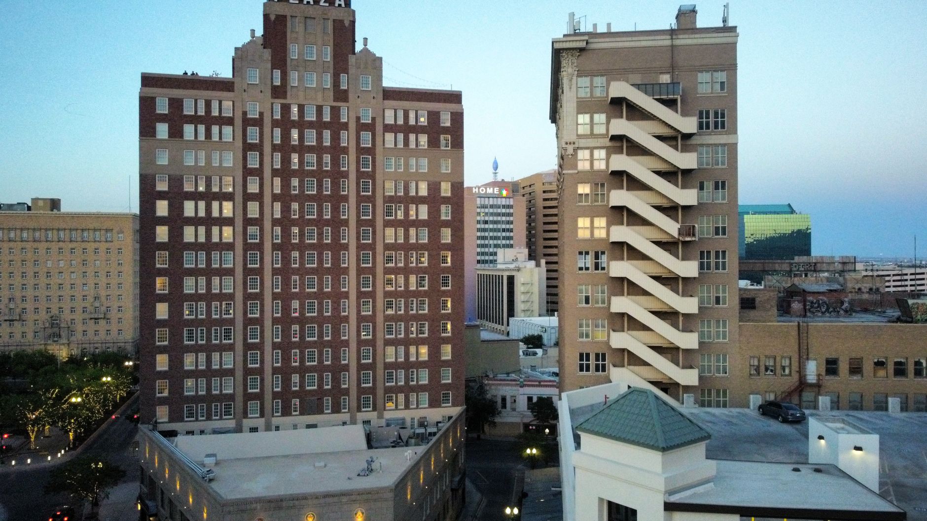
Essential 3-Day El Paso Itinerary: Practical Weekend Guide
A no-nonsense 3-day plan for El Paso with transit tips, neighborhood walks, key museums, and food suggestions to cover essentials efficiently.
A focused three-day plan for seeing the highlights: Franklin Mountains, Mission Trail, downtown theatres and Juárez-border perspective, with realistic transport and food tips.
This place reads as both desert wilderness and a working border city. The skyline is low; the Franklin Mountains rise abruptly from neighborhoods and create short, dramatic relief from flat streets. Streets near the border carry constant traffic, bilingual signs and vendors; downtown blocks are compact with an old theatre core, museums and municipal offices.
Expect noise near main roads and calm in foothill neighborhoods. Many visitors arrive thinking of a small Texas town and are surprised by active cross-border commerce, long-standing Mexican-American families, and serious outdoor recreation within city limits. The layout suits travelers who like short drives, broad views and mixed cultural programming rather than long gallery crawls or dense urban nightlife.
Is 3 days in El Paso enough?
Three days is enough to see the main public sites: Franklin Mountains State Park, Wyler Aerial Tramway, Mission Trail missions, downtown Plaza Theatre and a sampling of the food scene. Caveat: a true exploration of Ciudad Juárez or deep multi-day hikes in the mountains requires more time and paperwork.
Who This Guide Is For
Best for travelers who like short hikes, regional food, and a mix of museums plus urban viewpoints. Less suitable for visitors seeking a dense museum week or a major nightlife scene.
Local Tips for El Paso
Practical details that most travel sites skip — specific to El Paso.
- L&J Cafe on Oregon Street is the local-reference breakfast spot for smoky chili and machaca; expect a full plate for about $8–12.
- The Wyler Aerial Tramway parking lot is on Transmountain Road; the tramway operates on a limited schedule and can close for wind—call the Franklin Mountains State Park info number before driving up.
- Use the Paso del Norte Bridge (Santa Fe Street crossing) for pedestrian access to Avenida Juárez; bring a passport or SENTRI card and allow extra time for border inspection during morning and afternoon peaks.
- El Paso Museum of Art at Cleveland and San Antonio is free for general admission; special exhibitions may charge a separate fee.
- Buy Sun Metro passes on the official Sun Metro mobile app or at downtown vending kiosks before longer days; buses serve the downtown–Mission Trail–airport corridors but routes run less frequently late at night.
How This Guide Was Prepared
This guide treats El Paso as a border metropolis with outdoor options and a local food scene rather than a small Western stop. Many guides flatten the cross-border realities and underestimate how much time is spent moving between hillside overlooks, mission sites and downtown blocks. This guide was prepared through a structured research that combines destination research, geographic context, itinerary planning logic, and content review.
Plan Your Stay in El Paso
Use this itinerary as your starting point, then compare areas to stay, transport options, seasonal timing, and realistic daily costs before booking.
Why Visit
The mountains are immediate: Franklin Mountains State Park and the Wyler Aerial Tramway offer desert hiking and skyline panoramas within minutes of downtown. The Mission Trail covers three historic missions—Ysleta, Socorro and San Elizario—showing Spanish colonial and frontier layers rarely grouped so compactly.
Food and border culture are distinct: local places like L&J Cafe, Cattleman’s and street taco stands serve a regional mix of Chihuahua and West Texas flavors. Public cultural sites include the El Paso Museum of Art and Chamizal National Memorial, useful for understanding 20th-century US–Mexico relations. Finally, the border crossings and Avenida Juárez present an immediate perspective on everyday binational life without needing a long trip.
Quick Planning Tips
Fly into El Paso International Airport (ELP) for the fastest access; a taxi to downtown costs about $18–25 and rideshare prices are similar depending on traffic. Sun Metro buses connect airport and central neighborhoods; buying a pass via the Sun Metro app avoids cash fumbling. Pack sun protection and water for any Franklin Mountains hikes; summer heat exceeds 100°F (38°C).
Avoid the mistake of planning a Juárez visit without a passport and time for bridge inspection. Check museum hours in advance—many smaller sites close on Monday—and confirm Wyler Aerial Tramway status before heading up Transmountain Road.
Day 1
Morning: Start in downtown at the Plaza Theatre (105 E San Antonio Ave) to check guided-tour slots or ticketing for an evening show. Walk two blocks to the El Paso Museum of Art (1–2 blocks) for free general admission and a quick look at regional collections.
Lunch: Walk to L&J Cafe on Oregon Street (about 15 minutes from the museum) for enchiladas, staples and a neighborhood dining atmosphere. Early afternoon: Walk or take Sun Metro one or two stops to the El Paso Museum of History and the Arkeology sites near San Jacinto Plaza (5–10 minute transit or 10–15 minute walk).
Late afternoon: Drive or rideshare up to Scenic Drive and the Overlook for sunset views of the border and Juárez (20–30 minutes from downtown). Dinner: Reserve a table at Cattleman’s Steakhouse in the allowed sector of Franklin Mountains (25–30 minute drive); it is a local institution for grilled meats.
Evening: Return to Plaza Theatre for a performance if scheduled, or take an evening walk across San Jacinto Plaza to see local nighttime activity and park lights.
Day 2
Morning: Drive or take Sun Metro toward the Mission Trail starting at Ysleta Mission (about 20–25 minutes from downtown). Explore Ysleta, then continue west by car to Socorro Mission and San Elizario; allow 30–40 minutes of driving between sites for stops and short walks.
Lunch: Stop at Taqueria Juárez-style vendors near San Elizario or try local gorditas at La Joya Market; expect prices around $2–6 per item. Afternoon: Head to Chamizal National Memorial on the west side of the border for exhibits on the 1963 boundary settlement and periodic cultural events (allow 15–20 minutes from San Elizario).
Late afternoon: Visit the El Paso Holocaust Museum & Study Center or the Magoffin Home for neighborhood history in the Segundo Barrio area (10–20 minutes transit from Chamizal). Dinner: Try downtown contemporary dining or the emerging food scene along Mesa Street; many restaurants cluster within a 10–15 minute walk of the museum district.
Evening: If interested in nightlife, check bars on Larry Mahan Drive and the Mills area, but expect quieter late nights than in larger regional cities.
Day 3
Morning: Drive or take a bus up Transmountain Road to the Wyler Aerial Tramway trailhead; plan for a tram ride and a short ridge walk (20–30 minutes from downtown). Pack water and sun protection; tram operation depends on wind and staffing, so confirm hours before departure.
Late morning: Return to the Lower Valley for a visit to the El Paso Zoo or take a Detour to the Chamizal Farmers Market if it’s running (weekend mornings). Lunch: Eat at a tamale or taco stand in the Lower Valley—prices typically $2–8—and sample regional baked goods at independent panaderías.
Afternoon options for checkout travelers: If flight time is afternoon, leave luggage at the hotel and head to Bassett Place or the airport-adjacent shopping restaurants (10–20 minutes from downtown); if time permits, a quick visit to the Mission Trail or a final Scenic Drive stop offers a compact final impression. Allow at least 90 minutes to get to El Paso International Airport and check security for domestic departures.
Best Local Experiences
Walk Scenic Drive at sunrise for a quiet city-and-border panorama and quick photos. Hike any of the short routes in Franklin Mountains State Park; the Ron Coleman Trail and the Keystone Trail offer desert flora and skyline views. Spend an hour at the Wyler Aerial Tramway to gain elevation and a markedly different view of the city.
Drive the Mission Trail from Ysleta to San Elizario to visit three mission churches and small-town plazas. Visit Chamizal National Memorial for exhibits and occasional cultural programming tied to US–Mexico border history. Try a tamale from a Lower Valley vendor and compare it to a city-center gordita; the differences are instructive about regional ingredients and technique. Browse the weekend markets when available for baked goods, gorditas and local produce across neighborhoods.
Where to Stay
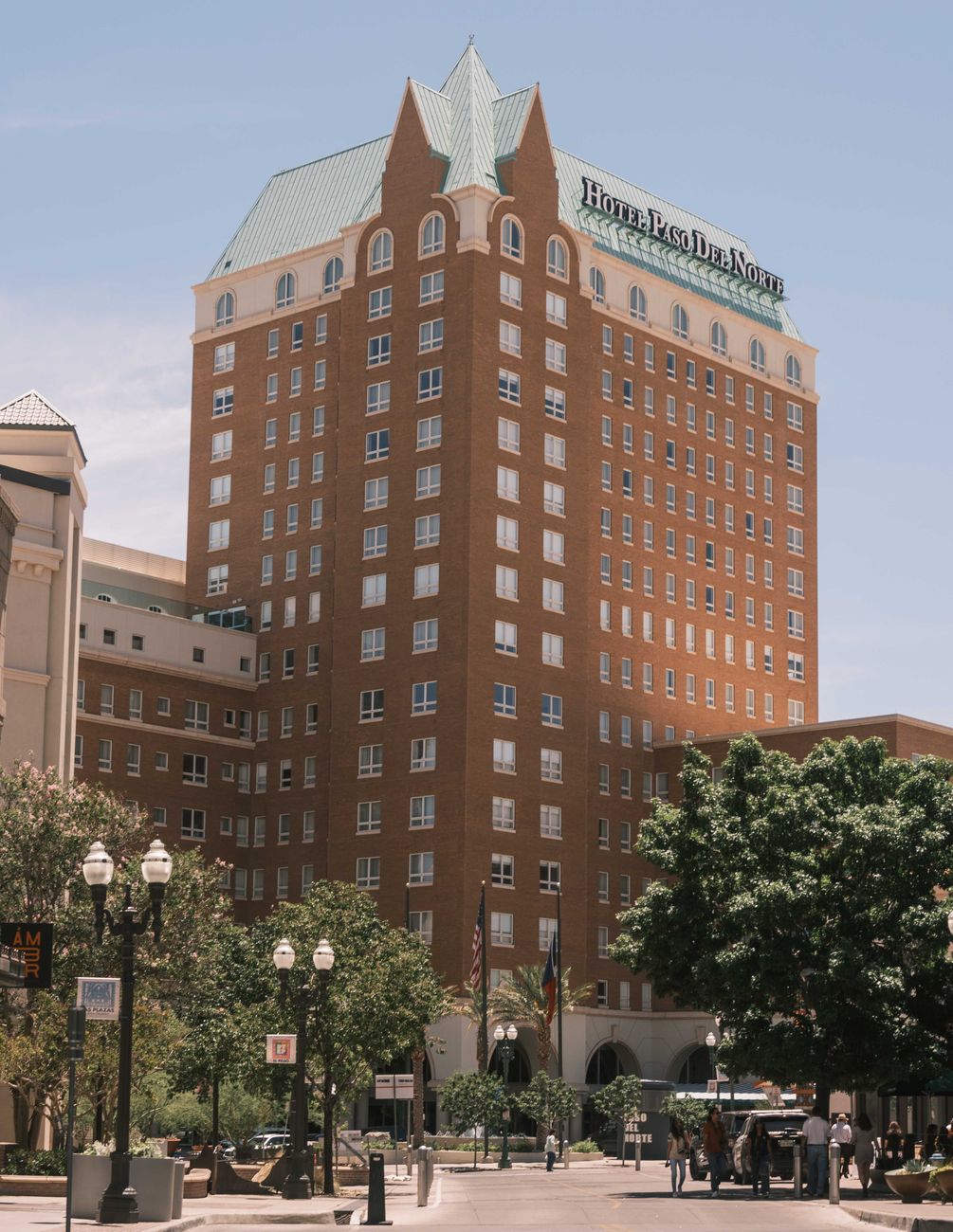
Downtown/Union Plaza: Suits travelers who want walking access to Plaza Theatre, El Paso Museum of Art and restaurants. Expect mid-range hotel rates of roughly $90–160 per night (USD), €85–150. The area is compact and good for those using Sun Metro or rideshare.
Mission Valley/Lower Valley: Suits visitors who prioritize Mission Trail access and quieter residential streets. Smaller guesthouses and motels run about $60–110 per night (USD), €55–100. This neighborhood requires driving for most downtown sites.
Eastside near Sunland Park/West El Paso: Suits travelers wanting proximity to Transmountain Road and the Wyler Aerial Tramway. Chain hotels and business hotels range from $80–140 per night (USD), €75–130. Travel times to downtown are 20–35 minutes by car depending on traffic.
Food and Drink
Machaca and egg breakfast: Shredded, rehydrated beef scrambled with eggs and peppers; find a solid plate at L&J Cafe for about $8–12. Tamales: Masa steamed in corn husk, often pork or chicken; Lower Valley vendors sell individual tamales for $2–4. Street tacos: Small corn tortillas with grilled meat or pastor; expect $2–4 each at stands near central plazas.
Carne asada or grilled steaks: Try Cattleman’s Steakhouse near the Franklin Mountains for large cuts, prices typically $25–40 for entrees. Menudo (breakfast soup): Traditional during weekend mornings at family-run spots; a bowl costs about $8–12. Agua fresca and Mexican horchata are common non-alcoholic options at mercado stalls for $2–3.
For a late-night snack, visit food trucks near downtown events; menu prices vary, but tacos and snacks commonly fall in the $3–8 range.
Getting Around
Public transit is Sun Metro buses. Key corridors connect downtown, the Mission Trail, and airport-adjacent routes. Single-ride bus fares are approximately $1.30; a day pass is about $3.00—buyable on the Sun Metro mobile app or at downtown vending kiosks. Routes run regularly during daytime but less frequently late at night.
Rideshare services operate across central and residential zones; airport pickup zones are clearly marked outside the main terminal. Taxis from El Paso International Airport to downtown typically cost $18–25. Use Google Maps or the Sun Metro trip planner for route planning; carry small bills for cash fares if the app cannot be used.
Best Time to Visit
Spring (March–May): Temperatures range from the mid-60s to mid-80s°F (18–30°C) with low humidity and wildflower season in the mountains; this is the best balance of weather and crowd levels. Summer (June–August): Very hot, often above 100°F (38°C); hiking requires early starts and extra water—crowds are lower but heat limits outdoor activity.
Fall (September–November): Pleasant temperatures in the 60s–80s°F (15–30°C), good for day hikes and outdoor dining. Winter (December–February): Mild days around 50–60°F (10–15°C) but nights can be cold; minimal crowds and lower hotel rates make this attractive for budget travelers.
Budget and Practical Tips
Sample daily budget (per person): Accommodation mid-range $90–140 USD (€85–130). Food $25–50 USD (€24–47). Transport $5–10 USD (€5–9) with local buses and occasional rideshare. Entry fees: Wyler Aerial Tramway donation or fee varies; Chamizal and El Paso Museum of Art general admission often free, while speciality sites may charge $5–15 USD.
Tipping norms follow U.S. standards: 15–20% in sit-down restaurants, $1–2 per drink at bars, and rounding up or 10–15% for taxi/rideshare drivers if service is good. Carry a mix of card and cash, as small markets and some vendors prefer cash.
FAQ
Is El Paso safe for tourists?
Many neighborhoods are routine for daytime visitors; standard urban caution applies—avoid poorly lit streets at night and monitor local news for any advisories.
How do I get from El Paso International Airport to downtown?
Taxi or rideshare takes 15–20 minutes and costs about $18–25; Sun Metro buses also connect the airport with downtown but require checking schedules.
Is a day pass for Sun Metro worth it?
Yes if planning two or more bus trips in a day; the day pass is typically cheaper than multiple single fares and convenient for museum-hopping.
Can tourists easily walk into Ciudad Juárez?
Pedestrian crossings exist at multiple bridges, but a passport is required and wait times vary widely; cross only if prepared and aware of current border conditions.
Are Franklin Mountains hikes difficult?
Trails range from short, moderate walks to strenuous climbs; pick trails like Ron Coleman for shorter options and bring water and sun protection.
Are museums open every day?
No; several smaller museums close one weekday—often Monday—so confirm opening days before planning a full museum day.
Is there good local Mexican food?
Yes; expect a distinct regional style influenced by northern Mexico and West Texas, with notable spots like L&J Cafe for breakfasts and numerous taco stands around the Lower Valley.
Is it easy to find ATMs and currency exchange?
ATMs are common downtown and at malls; currency exchange windows appear near bridge crossings and in some markets, but using local ATMs or card payments is generally the easiest option.
Conclusion
Three days deliver a clear sense of the place: mountain viewpoints, mission churches and a food scene shaped by the nearby border. Most travelers will remember the sudden transition from flat blocks to high ridgelines and the mix of Spanish-language life within U.S. institutions. If time gets tight, prioritize a mountain overlook (Scenic Drive or Wyler Aerial Tramway) plus one mission and an evening at the Plaza Theatre; those offer the strongest, quickest impression.
How this guide was prepared
This guide was prepared through a structured research that combines destination research, geographic context, itinerary planning logic, and content review.